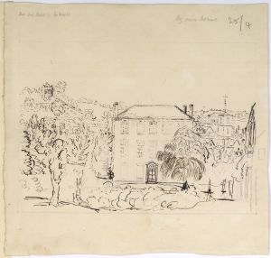
Drawings BEWDLEY (Worcestershire): Map of area
Object number
LDSAL2020.37.54
Production date
19th century
Material
paper
pen
ink
Wash
pen
ink
Wash
Technique
Drawing
Dimensions
Height: 370mm
Width: 495mm
Width: 495mm
Associated place
Bewdley
Newnham Bridge
Lem Hill
Rock
Mamble
Clows Top
Worcestershire
Cleobury Mortimer
Shropshire
Rea (river)
England
United Kingdom
Europe
Newnham Bridge
Lem Hill
Rock
Mamble
Clows Top
Worcestershire
Cleobury Mortimer
Shropshire
Rea (river)
England
United Kingdom
Europe
Inscriptions
Inscription content
Plan of Bewdley Road to Cleobury
References
Reference (free text)
'Presents to the Society', Archaeologia 29 (1842): 440.
Reference (free text)
Pamela J Willetts, Catalogue of Manuscripts in the Society of Antiquaries of London (Woodbridge: Brewer, 2000), pp. 244-5.
Reference (free text)
E A B Barnard, The Prattinton Collections of Worcestershire History (Evesham: The Journal Press, 1931).
Reference (free text)
E A B Barnard, Miscellanea II in the Prattinton Collections of Worcestershire History in the Possession on the Society of Antiquaries (1951).
Reference (free text)
E A B Barnard, 'Some Additional Notes Concerning the Prattinton Collections of Worcestershire History', Transactions of the Worcestershire Archaeological Society new series 8 (1931): 67-73.
Related items
 Drawings
BEWDLEY (Worcestershire): Redthorne House
Drawings
BEWDLEY (Worcestershire): Redthorne House
LDSAL2020.37.111
 Drawings
BEWDLEY (Worcestershire): Redthorne House
Drawings
BEWDLEY (Worcestershire): Redthorne House
LDSAL2020.37.129
 Drawings
BEWDLEY (Worcestershire): Waterside houses
Drawings
BEWDLEY (Worcestershire): Waterside houses
LDSAL2020.37.114
 Drawings
BEWDLEY (Worcestershire): Church of St Anne
Drawings
BEWDLEY (Worcestershire): Church of St Anne
LDSAL2020.37.117
 Drawings
BEWDLEY (Worcestershire): Church of St Anne
Drawings
BEWDLEY (Worcestershire): Church of St Anne
LDSAL2020.37.120
Drawings
BEWDLEY (Worcestershire): Redthorne House
LDSAL2020.37.111
Drawings
BEWDLEY (Worcestershire): Redthorne House
LDSAL2020.37.129
Drawings
BEWDLEY (Worcestershire): Waterside houses
LDSAL2020.37.114
Drawings
BEWDLEY (Worcestershire): Church of St Anne
LDSAL2020.37.117
Drawings
BEWDLEY (Worcestershire): Church of St Anne
LDSAL2020.37.120