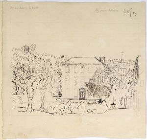
Drawings BEWDLEY (Worcestershire): Map of area
Object number
LDSAL2020.37.53
Artist/Designer/Maker
Young, George - Artist
Production date
1772
Material
parchment
pen
ink
Wash
pen
ink
Wash
Technique
Drawing
Dimensions
Height: 415mm
Width: 580mm
Width: 580mm
Associated place
Bewdley
Kidderminster
Areley Kings
Astley
Ribbesford
Hartlebury
Stourport-on-Severn
Severn (river)
Worcestershire
England
United Kingdom
Europe
Kidderminster
Areley Kings
Astley
Ribbesford
Hartlebury
Stourport-on-Severn
Severn (river)
Worcestershire
England
United Kingdom
Europe
Inscriptions
Inscription content
A PLAN of the several ROADS &c Betwixt Bewdley, Kidderminster, Redstone Ferry, & Dundley, in the County of WORCESTER: Also The situation of Stourport, the propos'd New Bridge, and Roads thereto: With the Course of the River Severn.
Survey'd and DRAWN By Geo: Young 1772.
Survey'd and DRAWN By Geo: Young 1772.
References
Reference (free text)
'Presents to the Society', Archaeologia 29 (1842): 440.
Reference (free text)
Pamela J Willetts, Catalogue of Manuscripts in the Society of Antiquaries of London (Woodbridge: Brewer, 2000), pp. 244-5.
Reference (free text)
E A B Barnard, The Prattinton Collections of Worcestershire History (Evesham: The Journal Press, 1931).
Reference (free text)
E A B Barnard, Miscellanea II in the Prattinton Collections of Worcestershire History in the Possession on the Society of Antiquaries (1951).
Reference (free text)
E A B Barnard, 'Some Additional Notes Concerning the Prattinton Collections of Worcestershire History', Transactions of the Worcestershire Archaeological Society new series 8 (1931): 67-73.
Related items
 Drawings
BEWDLEY (Worcestershire): Redthorne House
Drawings
BEWDLEY (Worcestershire): Redthorne House
LDSAL2020.37.111
 Drawings
BEWDLEY (Worcestershire): Redthorne House
Drawings
BEWDLEY (Worcestershire): Redthorne House
LDSAL2020.37.129
 Drawings
BEWDLEY (Worcestershire): Waterside houses
Drawings
BEWDLEY (Worcestershire): Waterside houses
LDSAL2020.37.114
 Drawings
BEWDLEY (Worcestershire): Church of St Anne
Drawings
BEWDLEY (Worcestershire): Church of St Anne
LDSAL2020.37.117
 Drawings
BEWDLEY (Worcestershire): Church of St Anne
Drawings
BEWDLEY (Worcestershire): Church of St Anne
LDSAL2020.37.120
Drawings
BEWDLEY (Worcestershire): Redthorne House
LDSAL2020.37.111
Drawings
BEWDLEY (Worcestershire): Redthorne House
LDSAL2020.37.129
Drawings
BEWDLEY (Worcestershire): Waterside houses
LDSAL2020.37.114
Drawings
BEWDLEY (Worcestershire): Church of St Anne
LDSAL2020.37.117
Drawings
BEWDLEY (Worcestershire): Church of St Anne
LDSAL2020.37.120